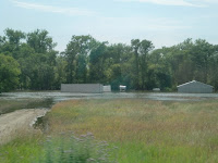


 On Monday before I flew back to LA we rode our bikes around to see the damage that the river flooding had caused as I had not seen it yet. It may be hard to tell as most of you all have not seen it before the flood so let me put it in perspective. The first picture you can tell that the water is to the bottom of the volleyball net, the playground is under water, and the roof over the picnic tables has water all under it. This whole area was never even CLOSE to the river's edge, much less under water. If you can see the little red monument in both the first and second picture, the bike path was on the far side of it and the river bank was out past the large group of trees in the second picture. The third picture is of a restaurant on the water where you can ride on the historic boat, but as you can see it looks like it is on an island surrounded by water since it and all the parking lot is underwater. The river bank was located about halfway between the road and the first support for the bridge. The fourth picture shows the whole road and all houses beyond that point under water...at the edge you see a canoe that the home owners have to take in to check on their homes, and then last picture is of the buildings under water. All this damage is near to the river and mostly on the same level as the river so needless to say "not a safe place to build" but still so sad to have so much destruction and the water is just sitting and will until probably end of August or more.
No comments:
Post a Comment